South taxiway closed for maintenance
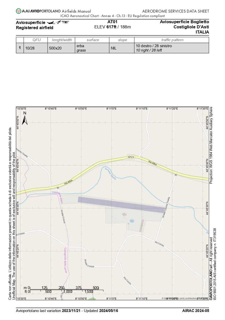
To reach holding point 10 or when landing from runway 28 use the north taxiway.
Exercise maximum caution when crossing the runway.
The Runway


Orientation
10/28
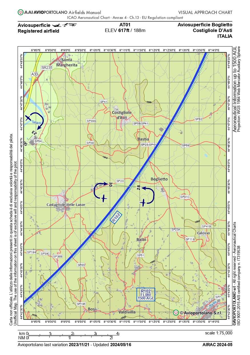
Runway 10
right-hand circuit, 1500ft
TORA 700 mt LDA 420 mt
Runway 28
left-hand circuit (standard), 1500ft
TORA 700 mt LDA 540 mt
Runway Data
Boglietto Airfield is a traffic circuit valid for all types of aircraft.
Elevation
617ft
Fuel
Green gasoline 100 octane
Surface
Grass
Frequency
130.00 MHz
Slope
Flat
Width
20 m
+10 m safety strip (on both sides)
Maximum Load
SIWL 2.8 tons
with dry runway
Weather Stations
Unknown
0 hPa
0 knots 0°
? °C
0 mm/hr
Last updated:
Unknown
Unknown
0 hPa
0 knots 0°
? °C
0 mm/hr
Last updated:
Unknown
Unknown
0 hPa
0 knots 0°
? °C
0 mm/hr
Last updated:
Unknown
Unknown
0 hPa
0 knots 0°
? °C
0 mm/hr
Last updated:
Unknown
Radar
Landing Contacts
Landing requires contacting the following numbers
to obtain prior approval and to receive updated information on the operational status of the airfield:
Operational Data
- Trees present (50ft) at both runway ends and on the north side of the runway
- Runway in a hilly environment
- CAUTION: in winter the valley floor goes into shadow (about 30 minutes before the official sunset time)
- In the presence of wind from the north quadrant exceeding 15 knots, turbulence may occur on the final approach in both directions
- Overflying the Boglietto area below 1500 ft is prohibited
- The safety area for runway 28 on the right side gradually disappears in the last 200 meters of the runway
- Always monitor frequency 130.00before takeoff and landing
- Arrivals/departures from Asti with altimeter set to 600ft (minimum altitude) to avoid turbulence


